The heavy restriction that prohibit motorized use as well as other uses in Wilderness Study Areas is still in place. The limited restrictions of a recreation area or special recreation area are lifted and replaced with possibly more stringent restrictions under a national monument. The heavy restrictions related to Canyonlands National Park and Natural Bridges National Monument are still in place.
Commentary by Monte Wells
Bears Ears Reduced … to what?
It has been good to see President Trump reduce the 1.3 million-acre Bears Ears National Monument to a few hundred thousand acres. This is the first time I’ve seen the government attempt to correct or change something that the government has done when the voice of the people cry for it to be changed. President Trump is not like other recent presidents. Thank goodness, he isn’t a politician.
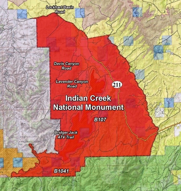
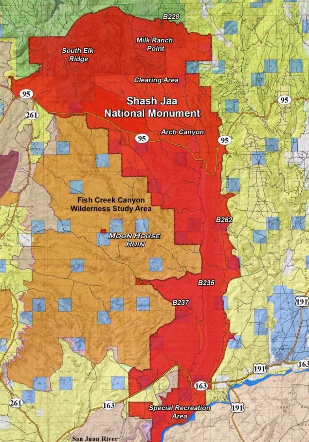
The reduction made two different monuments the Indian Creek National Monument and the Shash Jaa (Bears Ears) National Monument. The following map shows those boundaries and where they are located in San Juan County Utah.
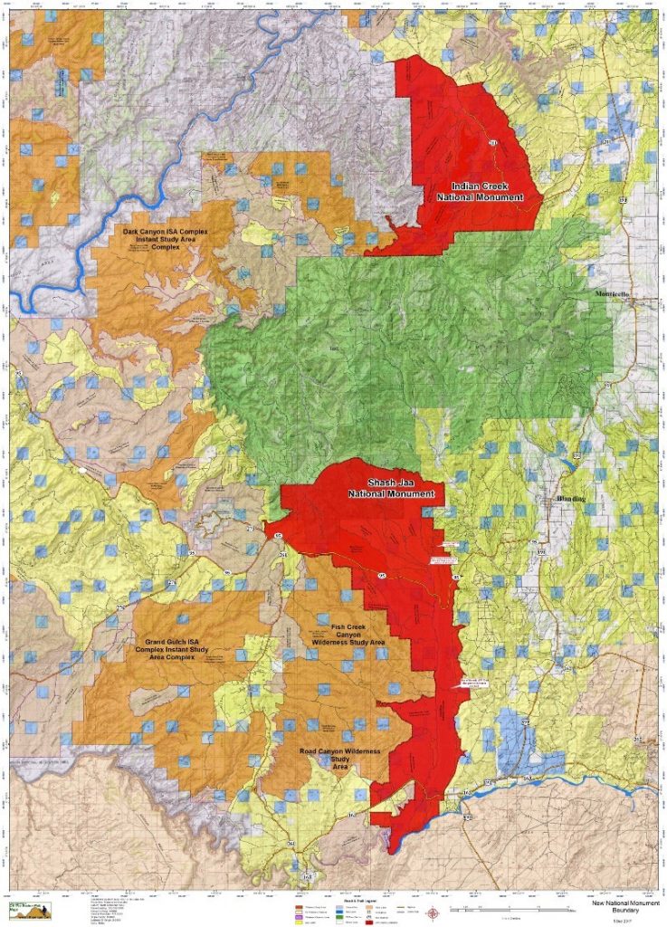
The map shows the new monument is red. It also shows other federal land designations in San Juan County.
The other colors on the map represent the following:
Yellow=Bureau of Land Management (BLM) Land
Dark Purple = Grand Gulch Primitive Area
Green = US Forest Service (USFS) Land
Dark Green= Dark Canyon Wilderness Area
Blue = State Lands (SITLA)
Light purple= National Monument or Glen Canyon Recreation Area
Orange Tan = Wilderness Study Areas that are operated like wilderness areas
light Tan = Reservation Land
Sand Tan = Areas with Wilderness Characteristics
The areas selected for the new national monuments aren’t the areas with the most archaeological sites or the most popular locations for those looking at archaeological sites. They are not the most undeveloped areas with low traffic or the most pristine areas that were located within the 1.3 million acres originally. They appear to be two areas that have been the center of years of planning and debates with environmental groups. I can’t help but wonder who recommended them to Secretary Zinke and President Trump and who drew up the boundaries?
Let’s take a minute and I will give you a better understanding of these two areas and what these designations has done to the region if anything.
Indian Creek National Monument
Indian Creek was designated as the Indian Creek Recreation Area (ICR) a few years back originally but only included Indian Creek for the most part. There was a small part that went up North Cottonwood.
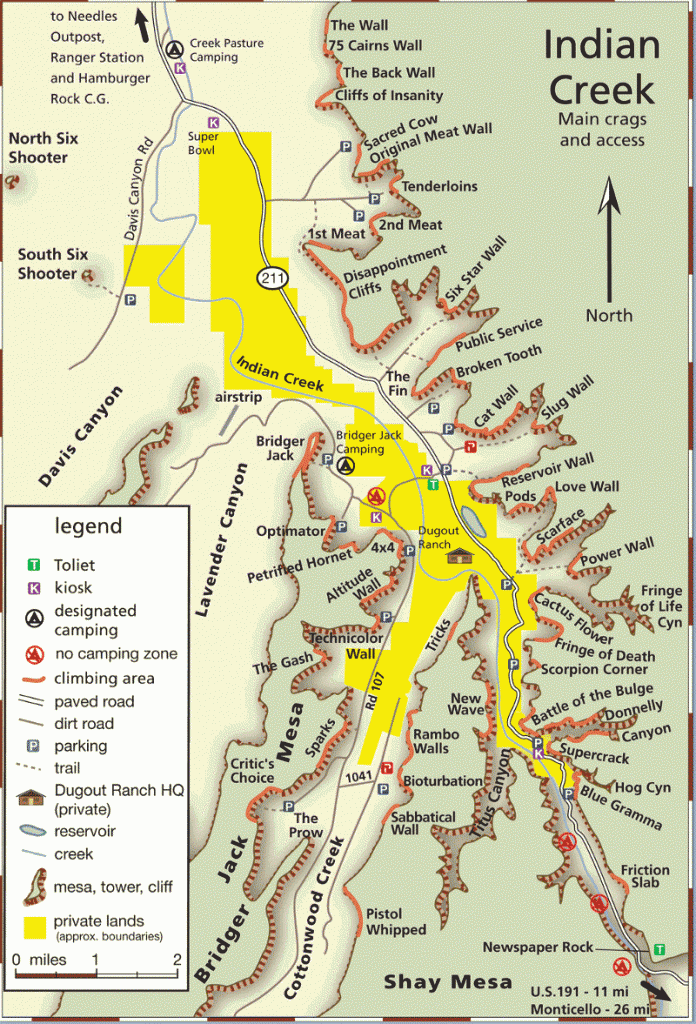
The planning and development of the ICR area started back in the 1991. Those involved in the planning at various stages involved the BLM, Dugout Ranch, Nature Conservancy, Access Fund a climbing organization, and others. The environmental assessment UT-090–00–47 that was done as a step in the development was signed off on October 21, 2005 by Sandra Meyers Monticello BLM Field Office Manager at the time.
It wasn’t long before the BLM started putting up kiosks, sign in boxes, and pay boxes at the campgrounds in Indian Creek. The put in restrooms, paved a parking lot for the climbers and so on. They also began putting up kiosks and pay boxes. The BLM was also putting up pay boxes on Cedar Mesa and in Comb Wash around the same time.
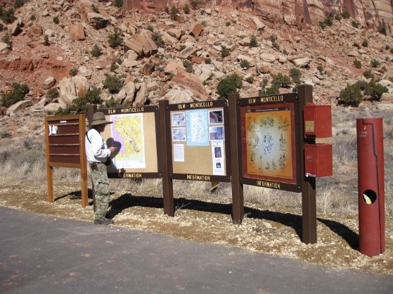
At this point the BLM began to close a lot of roads and longtime camping areas in the Indian Creek area.
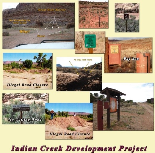
With the major developments by the BLM in Indian Creek became it appeared they were violating the 2005 EA.
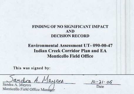
It wasn’t until later after being questioned about the campground development the and the paved parking lot the BLM produce updated EA’s for each area.
These issues were brought before the San Juan County Commissioners on several occasions and, yet nothing ever changed. On one occasion the BLM closed a county road illegally in Indian Creek while working on a campground.
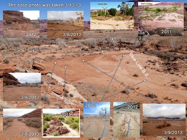
The Petroglyph documented the illegal closure of county road D0570 and turned it into the county commissioners. The pictures above from 2011 and 2012 documented that illegal closure. The BLM obstructed the county’s criminal investigation and county officials decided to drop the investigation.
This development in Indian Creek was to create a climbing recreation area. During the planning periods of the Public Lands Initiative in 2012 and 2013 the environmental community as well as Friends of Indian Creek were working with Governor Herbert and Congressman Bishop to create a climbing recreation zone in Indian Creek.

Indian Creek has a lot of rock art throughout the area. Newspaper Rock was a State Historic Monument prior to the designation.
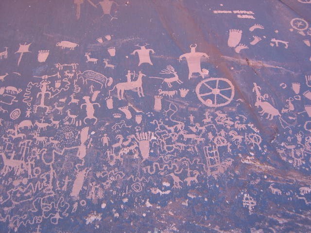
There is archaeology in the area just like anywhere in San Juan County but not as much as Cedar Mesa. It is one of the three places I know of that you can see dinosaur tracks in the county. Despite this the major draw to Indian Creek is the climbing. In the falls and spring hundreds if not thousands of climbers come to the area.
Understanding the history behind the Indian Creek Recreation Area gives us an idea who was behind pushing for Indian Creek to be made a national monument. It also points the finger at state officials, Nature Conservancy, Heidi Redd of the Dugout Ranch, and the Friends of Indian Creek as having a considerable influence on its designation.
The Nature Conservancy bought the Dugout Ranch from Heidi Redd in 1995 and took over the operation of the ranch around 2014 or so. The ranch operated on some 400,000 acres of public and private land until the national monument designation. The Nature Conservancy was a supporter of Bishops Land Initiative and one source reported that it was because the PLI would remove the state lands out of Indian Creek away from the ranch. The current national monument designation will do the same thing. It will be interesting to see what happens to the BLM cattle allotments in North Cottonwood and Indian Creek now.
What is going to happen to the Bridger Jack ATV Trail and parts of the #1 ATV trail that are in the Indian Creek NM now. There is also a major access road CR B107 that provides access to Elk Ridge, Beef Basin, and CR B 1041 to Mormon Pasture. Will these roads always be accessible, or will we have to have a National Monument pass every year to use them?
Shash Jaa National Monument
The Shash Jaa NM area has had a lot of impact as well just like Indian Creek. There are two major highways that run through the NM Hwy 95 and Hwy 163. It not only takes in those two major routes, but it takes in old Hwy 95 and CR B228 that was the old route from Blanding Utah to the Colorado River now part of the Glen Canyon Recreation Area. The only other motorized routes from the east side of San Juan County to the west side that doesn’t travel through a monument now is the Causeway CR B225, CRB268 to CR B227 all maintained dirt roads.
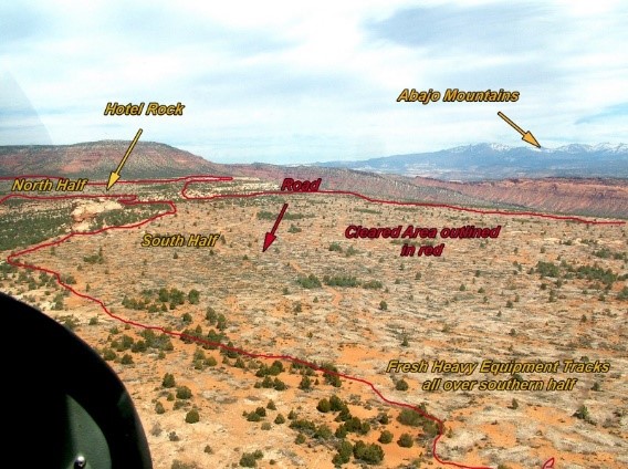
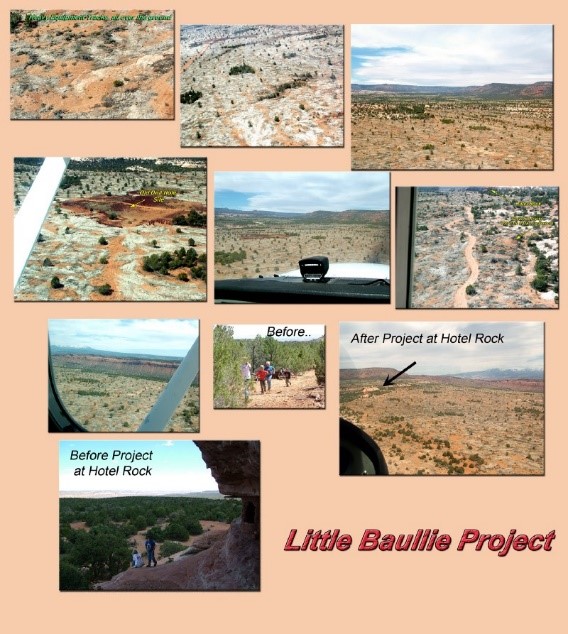
On major project in the new monument area was the Little Baullie Mesa Project. In 2010 the BLM did a clearing project on Little Baullie Mesa that covered 1653 acres next to Arch Canyon and Comb Wash.
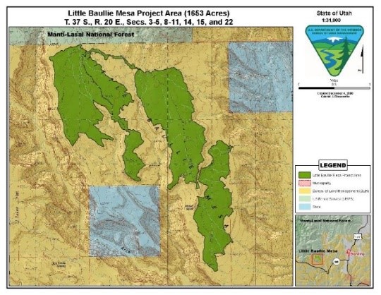
Little Baullie Mesa was home to hundreds of Archaeological sites and some were left undamaged during the clearing process as indicated by the groups of trees on the mesa. There were many sites that were ran over and were impacted by the clearing that was done by heavy equipment.
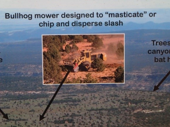
The trees were chewed up (masticated) and left on the ground as the BLM illustration below shows.
Archaeological sites were driven over, and artifacts were displaced by the heavy equipment.
One of the canyons that borders Little Baullie Mesa is Arch Canyon.
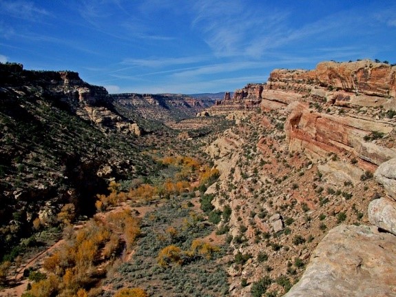
Arch Canyon is the only canyon in the Comb Wash / Cedar Mesa area that has a motorized trail in it. The trail is eight-mile-long and used by jeeps, ATVs, hikers, bikes, etc. The Arch Canyon trail has been the point of many battles between the BLM, some Native American groups, and San Juan County for years. The idea that areas can be used for multiple use is a good one, but special interest groups and the environmental industry just can’t grasp the concept. Out of hundreds of miles of canyons left to hike in it is this 8-mile trail that stands out.
The Arch Canyon trail is one of the main attractions during the San Juan County ATV Safari. It is also a popular trail with tourist that enjoy motorized recreation.
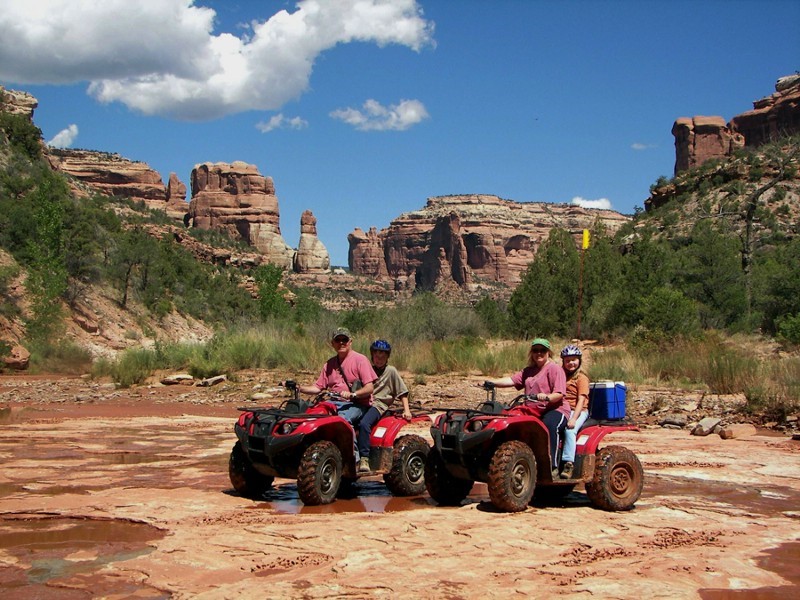
With the designation of the Shash Jaa National Monument I wonder how long Arch Canyon will stay open.
There are several large camping areas in Comb Wash as well as the old Hole in the Rock Pioneer Trail that is used by motorized vehicles to access Cedar Mesa and on down to San Juan Hill where the pioneers cleared their last major obstacle before reaching Bluff Utah. Now this entire area is in the monument and includes the River House Ruins. The route to River House Ruins, San Juan Hill, and the Barton Trading Post is all part of the River House Ruin ATV trail. This is also a popular trail with tourists and part of the San Juan County ATV Safari.
There used to be a camping area near a popular boat launching area also near the ruins but the BLM closed the area to camping.
Also in the area is the old Barton Trading Post seen below before it was fenced in.

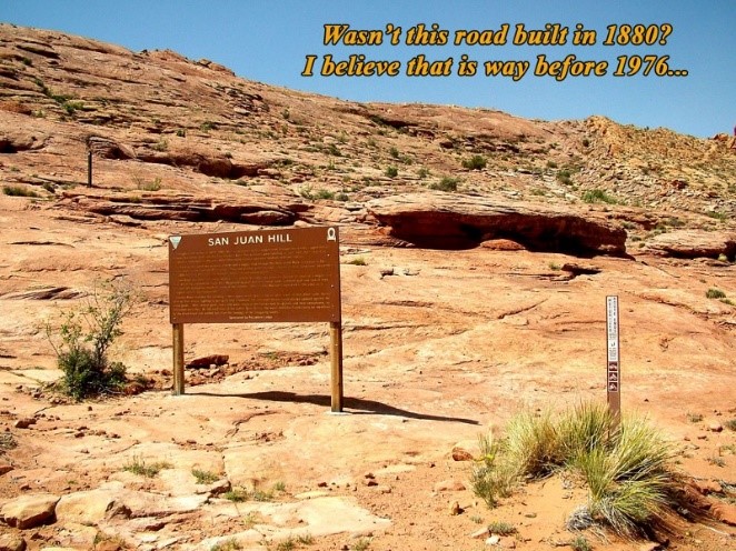
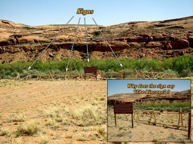
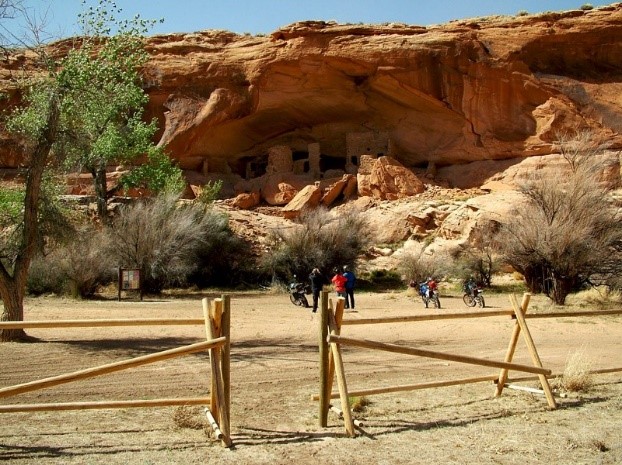
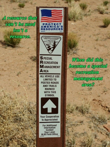
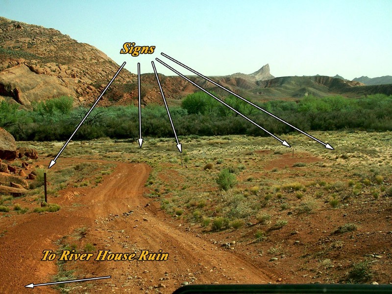
This area near the San Juan River was designated a Special Recreation Area several years back prior to the Shash Jaa National Monument. The below sign was located along the road to River House Ruin.
All the signs in the picture below were also located in this Special Recreation Area.
As a recap the Shash Jaa National Monument now covers a 1600-acre clear cutting project, multiple popular camping areas, a Special Recreation Area at River House Ruins, Arch Canyon OHV Trail, Old Hwy 95 dugway, Butler Wash Rest Area, Mule Canyon Rest Area, and two major state highways 95 and 163, as well as county roads CR B 235 down Comb Wash, CR B 262 down Butler Wash, and CR B237 Snow Flat Rd or Hole in the Rock Trail.
Conclusion
So, what did we gain or not gain from this reduction of the Bears Ears National Monument?
The monument went from 1.3 million acres to a few hundred thousand acres of public lands.
The Indian Creek Recreation Area grew bigger and borders Canyonlands National Park, Butler Wash Wilderness Study Area, and the USFA to the west, SW, and South. On the north it borders BLM Land.
Shash Jaa borders the Fish Canyon Wilderness Study area, Valley of the Gods, and USFS lands to the west and north. It borders BLM land to the east.
All the wilderness study areas except Bridge Jack and Mule Canyon are still intact. All the Wilderness Character lands are still intact except what was covered by the monuments.
All the BLM, USFS, Wilderness, and Primitive Areas are still intact except where covered by the national monuments.
All the state SITLA lands will be removed from the national monument areas and probably moved out of San Juan County.
The heavy restriction that prohibit motorized use as well as other uses in Wilderness Study Areas is still in place.
The limited restrictions of a recreation area or special recreation area are lifted and replaced with possibly more stringent restrictions under a national monument.
The heavy restrictions related to Canyonlands National Park and Natural Bridges National Monument are still in place.
BLM restrictions to motorized use and multi-use on BLM lands to include Recapture Canyon are still in place. Oil and Gas permits are still very limited in San Juan County. The Gunnison Sage Grouse protection area east of Monticello on private property is still in place.
Three major access routes to the western part of San Juan County now fall under the control of the Department of Interior in the National Monuments.
If the designation would have been for Cedar Mesa it would have replaced the Grand Gulch Primitive Area, the large areas of Wilderness Study Areas, and left Comb Wash as it was along with Butler Wash. Instead we ended up with public lands that weren’t as restrictive and heavily used being made more restrictive and all the thousands of acres of wilderness study areas, and wilderness left the same with heavy restrictions.
We gained nothing with the reduction it appears. We lost ground when it comes to areas being more restricted and controlled. The environmental industry gained Arch Canyon, Indian Creek, Comb Wash, Comb Ridge, Butler Wash, Whiskers Draw, South Elk Ridge, Bridger Jack, North Cottonwood, Bridger Jack ATV Trail, River House Ruin ATV Trail, control of three major highways and accesses to the western part of San Juan County from Hwy 191 corridor and so on.
This is not President Trumps fault or even Secretary Zinke’s fault as far as I can tell. We were betrayed by our state officials Senator Hatch, Congressman Bishop, Governor Herbert, and others. When speaking about the Bears Ears National Monument Senator Lee was the only one than continually stated that it should be rescinded.
No, President Trump did what the Utah delegates wanted. President Trumps speech at the signing was one of the best presidential speeches I have heard in a long time if ever. It was good to see the President of The United States working to undo the wrong that had been done. It’s just too bad that we are being sold out by those closest to us our Utah delegates and our local state leaders. Senator Lee was the only delegate to stand his ground on rescinding the entire Bears Ears National Monument the rest abandoned the cause to promote their own agendas.
See more from Monte Wells at The Petroglyph
[paypal_donation_button]
Free Range Report
[wp_ad_camp_3] [wp_ad_camp_3] [wp_ad_camp_3]
[wp_ad_camp_2]
