“It was our contention all along that the BLM’s surveys were conducted improperly and unlawfully,” Paxton said in a statement. “We will vigilantly defend Texas’ border from federal overreach.”
David Lee
Texans applaud suspension of U.S. land surveys
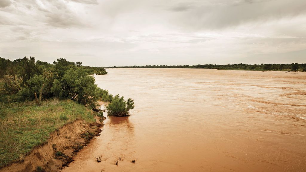
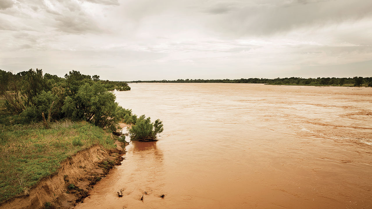
WICHITA FALLS, Texas (CN) – Texas landowners cheered Friday for the U.S. Bureau of Land Management’s halting of controversial Obama-era land surveys along the Red River boundary with Oklahoma that they deemed a 90,000-acre land grab.
Several landowners, three counties and one sheriff sued the BLM in 2015 in federal court, claiming it is “well-established” that Texas begins at the southern bank of the Red River and federal ownership is limited to the bottom half of the sandy riverbed outside of the state. The lawsuit says the BLM claims the boundary extends past that, sometimes by over a mile.
BLM spokesperson Paul McGuire told Media Matters in 2014 that the agency’s land surveys are part of a “broad-based planning effort” for Kansas, Oklahoma and Texas, saying periodic surveys are needed in response to technological and landscape changes.
As an example, McGuire said “the consequences of hydraulic fracking” are “precisely the type of thing we’d be looking at in more detail.”
“It is a routine thing that BLM does. The plans that we rely on generally have to be updated every 15 to 20 years. So the ones that we currently have on the books for this year date back to the 1990s. It’s much broader than the Red River but we have a strip of land in the region,” McGuire told the publication.
BLM has denied that it plans to engage in a future “land grab” around the Red River, but landowners still alleged that the surveys meant the federal government claimed it owns up to 90,000 acres of Texas land along 117 miles of the river.
On Tuesday, the BLM filed a notice with the court to suspend three of the land surveys. The filing cites a March 29 letter that Steve Beyerlein, acting BLM chief cadastral surveyor, wrote to New Mexico authorities that admits to “incorrect methodology” being used in the surveys.
“BLM has recently obtained new information (including in a deposition on March 2, 2017 taken in that lawsuit) that brings into question whether the doctrines of erosion, accretion and avulsion were appropriately considered,” Beyerlein’s letter states. “Having reviewed this deposition testimony and other new information, the BLM believes the survey methodology used was in error, and may have caused errors in identifying the location of the gradient boundary.” (Parentheses in original.)
Beyerlein said the land surveys may be cancelled, corrected or reinstated after an investigation is conducted.
Texas Attorney General Ken Paxton applauded the Trump administration Friday for protecting Texans’ property rights and preventing the federal government from infringing on the state’s sovereign borders. Paxton intervened on the landowners’ behalf days after their lawsuit was filed, calling the action an illegal “land grab” by federal officials.
“It was our contention all along that the BLM’s surveys were conducted improperly and unlawfully,” Paxton said in a statement. “We will vigilantly defend Texas’ border from federal overreach.”
The landowners’ attorney, Rob Henneke with the Texas Public Policy Foundation, said the letter shows his clients’ argument that the BLM was not in compliance with a U.S. Supreme Court ruling has merit.
“That’s been a position that, up until now, the government has never agreed with and has never taken,” he told the Wichita Falls Times Record News on Wednesday. “So, it’s significant that it’s a change in the way they see the case.”
U.S. District Judge Reed O’Connor dismissed the landowners’ Fifth Amendment claims against the BLM last June, but allowed their request for declaratory judgment, mandamus and an injunction “regarding the method for locating the boundary between their property and federal territory” to move forward, finding they have constitutional standing.